
Map of planet Earth jetstreams, which indicates that the tropics wobble.

Map of planet Earth equator and tropics of Cancer and Capricorn
Maybe these lozenge maps should be called 'displacement along wobble normalized maps'.

Sega Saturn logo
Sega is ages reversed, Saturn is time lord, maybe the S band indicates areas of displacement due to gravity (gravitons).The public doesn't know many times the (total) surface of the planet Earth has been mapped by (spy) satellites.


Couldn't find image of person sitting on Sputnik looking at Earth to determine orientation, but you can imagine Sputnik as the head of a snake, the antennae being it's fangs.
/Update%2089/22-015.png)
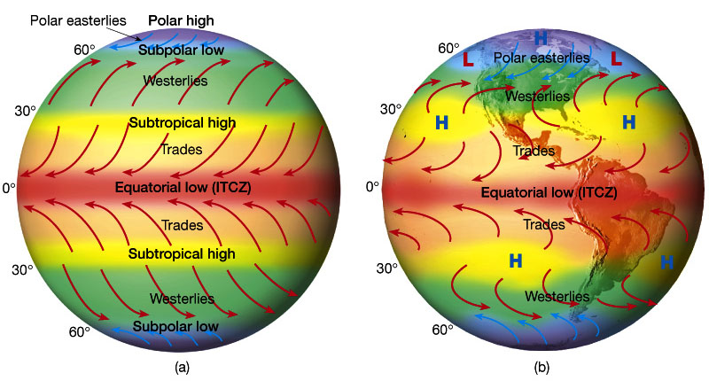
Although it was implied in the juxtaposition of images, for clarity, on the jetstream map the parts marked 'high' vertically closest to the yellow line which coincides with the equater, coincide with the tropics. Outward from the green wiggly lines, are the subtropics.
The tropics would be better represented as bands on your map, the lines would indicate the deviance of the green wiggly between tropics and sub-tropics.

No comments:
Post a Comment